In this section: |
This section provides the prerequisites for WebFOCUS GIS Viewer for Flex.
WebFOCUS GIS Viewer for Flex requires:
Note: Map services published on ArcIMS will not work.
You must first create a map document on your local file system. This map document will not be available to client applications until the map service is published.
The data needs to be stored in a way that the Server Object Container (SOC) machine for ArcGIS Server can access it. What this means is that when a map document is published as a service, both the map document and all its layers in the map document needs to be accessible by the SOC machine.
Use Universal System Convention (UNC) paths instead of mapped paths for network data. If the data is stored in a local hard drive, then use a mapped path. If your shape files are stored in a shared directory, then use UNC paths so that the SOC machine can access it.
In order for the SOC machine to access the data, grant SOC account (ArcGISSOC) permissions to use the data. This is the SOC user account you specified during ArcGIS Server Post Install. Grant the account read access to your data.
How to: |
You can create a map service using one of the following options:
To grant permissions, add your logon for the system where ArcCatalog is installed as a user to the agsadmin group in the ArcGIS Server system.
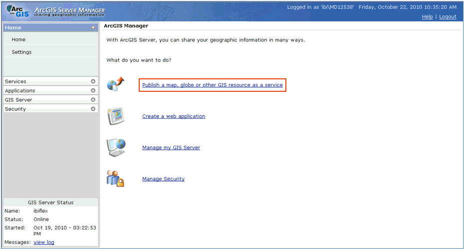
To publish a map service using the ArcGIS Server Manager Console:
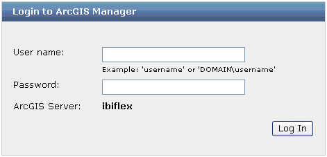
The Login to ArcGIS Manager dialog opens.
The ArcGIS Server Manager Console Home page opens.
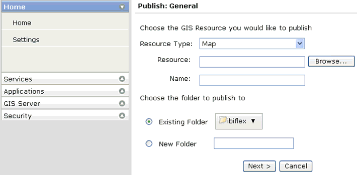
The Publish: General page opens.
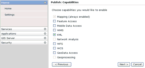
The Publish: Capabilities page opens.
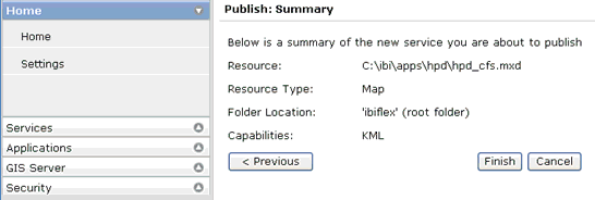
The Publish: Summary page opens.
To use ArcCatalog to connect to the ArcGIS Server and create the map service:
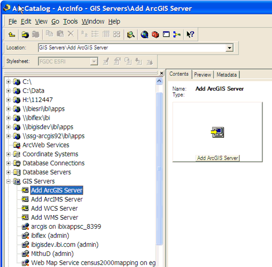
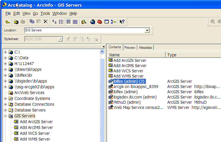
The ArcCatalog opens, as shown in the following image.
You must first create a connection to the ArcGIS Server.
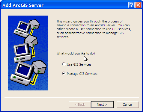
The Add ArcGIS Server wizard opens, as shown in the following image.
The General pane opens.
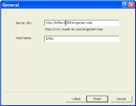
http://<ArcGIS ServerHost Name>:<port number>/arcgis/servicesThis is the URL on which the map services are displayed. By default, ArcGIS Server listens on port 8399.
Typically, this is the ArcGIS Server host name.
The new connection is added to the ArcCatalog, as shown in the following image.
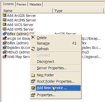
You are now ready to create a map service.
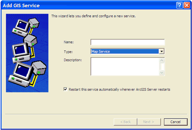
The Add GIS Service wizard opens, as shown in the following image.
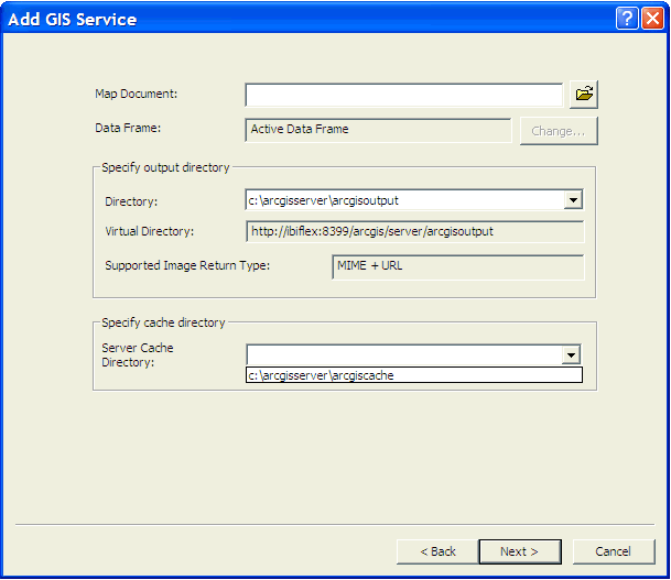
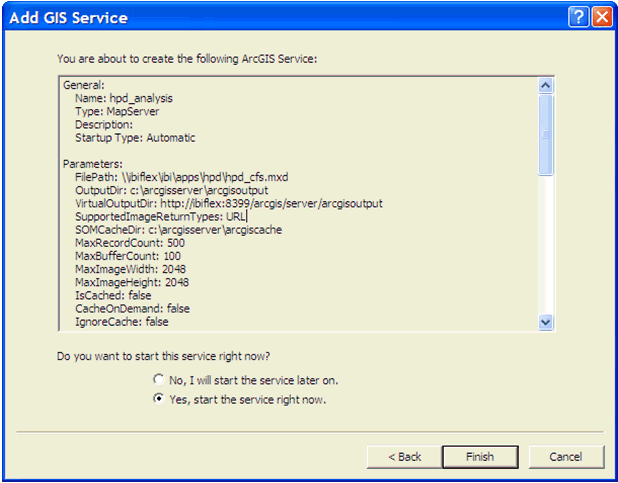
The following pane opens, prompting you to specify the map document (.mxd), output directory, and cache directory.
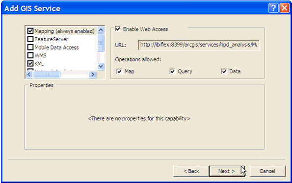
The following pane opens.
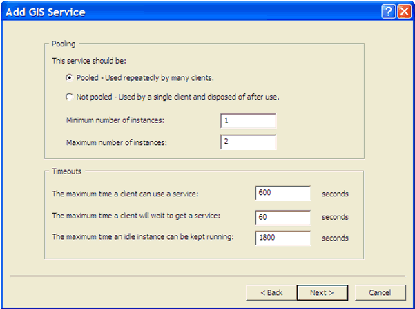
The following pane opens.
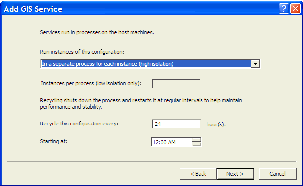
The following pane opens.
The Summary pane opens, as shown in the following image.
You have successfully created a new map service using ArcCatalog.
You are now ready to create the map cache.
To create the map cache:
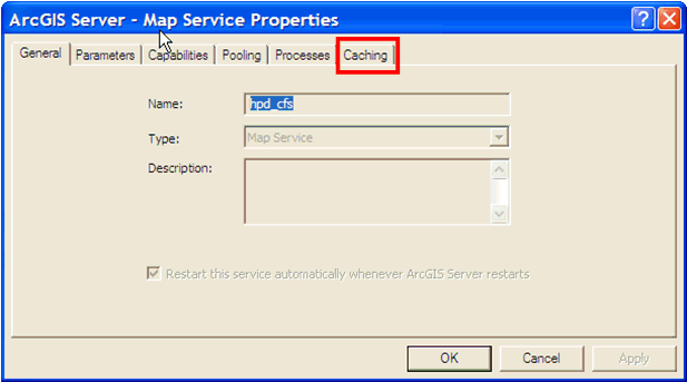
The Map Service Properties dialog opens.
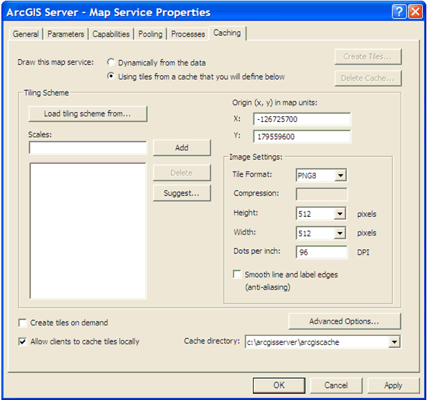
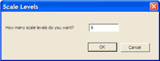
The Scale Levels dialog opens.
You are returned to the Caching tab of the Map Service Properties dialog.
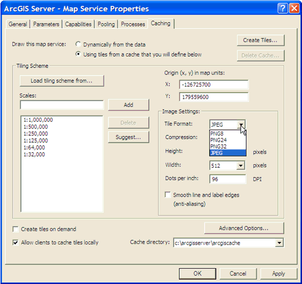
The JPEG format produces small tiles and will reduce the required disk space to store the cache. In addition, clients can also load the tiles faster.
Note: This step assumes that you are not going to overlay this cache on another service. For overlay services, such as road and boundary networks, it is recommended to use the PNG8 format instead.
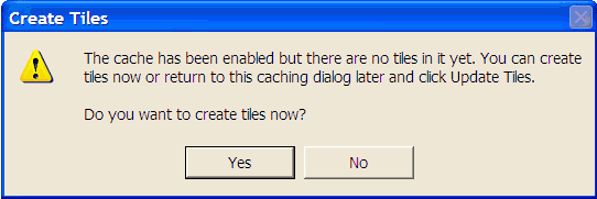
The Create Tiles dialog opens.
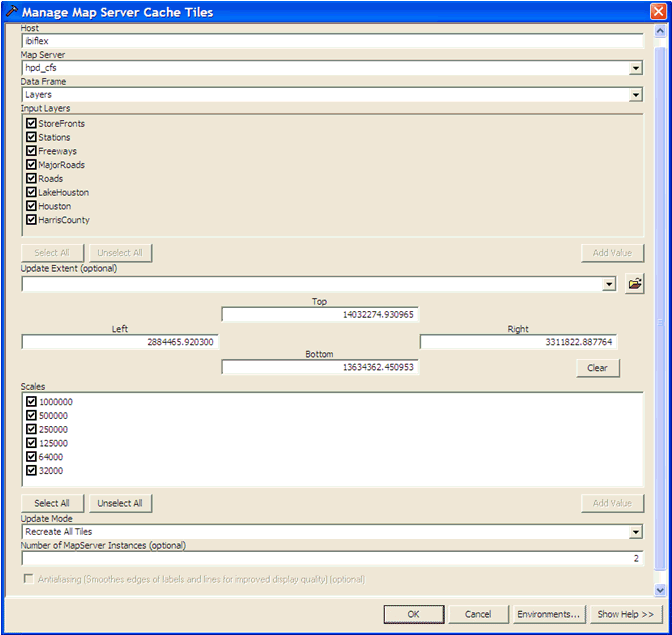
The Manage Map Server Cache Tiles dialog opens, as shown in the following image.
The following dialog opens, which shows the progress of the tile creation process.
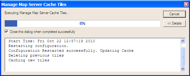
Once the process has finished, you must clear the REST cache.
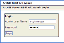
To clear the REST cache:
http://<ArcGISServer>:8399/arcgis/rest/admin/The following login page opens.
The REST API Admin page opens, as shown in the following image.
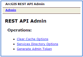
The Clear Cache Options page opens.
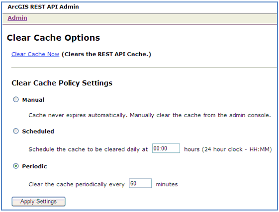
You can also select the Scheduled or Periodic option to clear the cache automatically based on the time values that you specify.
Before you deploy WebFOCUS GIS Viewer for Flex, ensure that the crossdomain.xml file is included in the root directory where ArcGIS Server is installed. This file is used to access data from a different server other than the one hosting the WebFOCUS GIS Viewer for Flex application.
For security reasons, Flex cannot access data other than where the .swf file for the deployed application is located. This is the primary reason why the crossdomain.xml file must reside on the remote server (ArcGIS Server). As a result, permissions are granted to Flash to access the services on the remote server. The crossdomain.xml file must be structured, as shown in the following example:
<?xml version="1.0"?>
<!DOCTYPE cross-domain-policy SYSTEM "http://www.adobe.com/xml/dtds/cross-domain-policy.dtd">
<cross-domain-policy>
   <site-control permitted-cross-domain-policies="all"/>
   <allow-access-from domain="*"/>
</cross-domain-policy>
For more information on how to configure the crossdomain.xml file, see the following web site:
| WebFOCUS |