In this section: |
The default number of map features that can be selected by an end-user is 2000. This is an attempt to reduce the answer set to something that every relational database can manage as part of a WHERE IN clause.
The WebFOCUS GIS adapter now allows you to increase this number for high-volume map selection situations. When a large number of features are selected, some alternate techniques are necessary within the WebFOCUS procedure to incorporate the larger filter list.
The maxfeatureitems attribute can be found within the <Performance> tag.
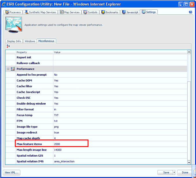
You can set the Max feature items parameter using the ESRI Configuration Utility. Click the Settings tab located at the top of the ESRI Configuration Utility. Then click the Miscellaneous tab. Scroll down to the Performance section, as shown in the following image.
When using a maxfeatureitems value greater than 2000, the developer must specify Data in File as the input format for the inbound layer.
Note: Attempting to use Amper as String or Amper as Number to pass many filter values may generate an error message.
Within the FOCEXEC, the developers should code a JOIN statement that uses the attribute name and File name from the inbound map layer definition.
For example, if you are working with the CRIME data and want to select many individual crimes from the map layer, the inbound definition would specify All crimes as the layer ID, the attribute name would be REPORTID, and the file name could be MAXITEM.
The JOIN would look like:
JOIN REPORTID IN MAXITEM TO REPORTID IN CRIMEDATA AS J1
Then the TABLE request would begin as follows:
TABLE FILE MAXITEM
...
If there is a difference between the format or length of the map layer attribute and the field length or format in the WebFOCUS data source, a JOIN will not work. One alternative is to create a DEFINE-based JOIN. Another alternative is to use MATCH FILE.
| WebFOCUS |