Drawing Multiple Map Layers
In general, the information required to draw particular
features on a map come from different structures within a database
or even different databases.
Begin by creating a FOCEXEC with multiple TABLE requests. If
you already have separate MAP type procedures, it will be easier
to begin by combining the code from each into a single procedure.
The filtering code is still necessary for each request. The filter
list will be made available by the WebFOCUS GIS adapter based on
the INBOUND layer definition.
Make sure that you uniquely name the rendering elements in each
TABLE request. The rendering elements are the fields in the request
associated with COLOR, SHAPE, SIZE and TITLE. An easy way of keeping
track of each is to add the layer ID value to the end of the rendering
element name.
TABLE FILE data_layer_1
PRINT colname1
  COMPUTE COLOR1/A25='RED';
  COMPUTE TITLE1/A255='your title goes here for layer 1';
-*
-IF &FLTRLST1.EXIST NE 1 GOTO SKIP_FILT_1;
  IF some_field EQ (&FLTRLST1)
-SKIP_FILT_1
-*\
ON TABLE PCHOLD FORMAT XML
END
-RUN
-*
TABLE FILE data_layer_2
PRINT colname2
  COMPUTE COLOR2/A25='BLUE';
  COMPUTE SIZE2/A3='10';
  COMPUTE SHAPE2/A10='STAR';
  COMPUTE TITLE2/A255='your title goes here for layer 2';
-*
-IF &FLTRLST2.EXIST NE 1 GOTO SKIP_FILT_2;
  IF some_field EQ (&FLTRLST2)
-SKIP_FILT_2
-*
ON TABLE PCHOLD FORMAT XML
END
Open the definition editor and access the appropriate application.
Create a configuration for a MAP type FOCEXEC. Depending on the
particular data circumstances it may be necessary to create multiple
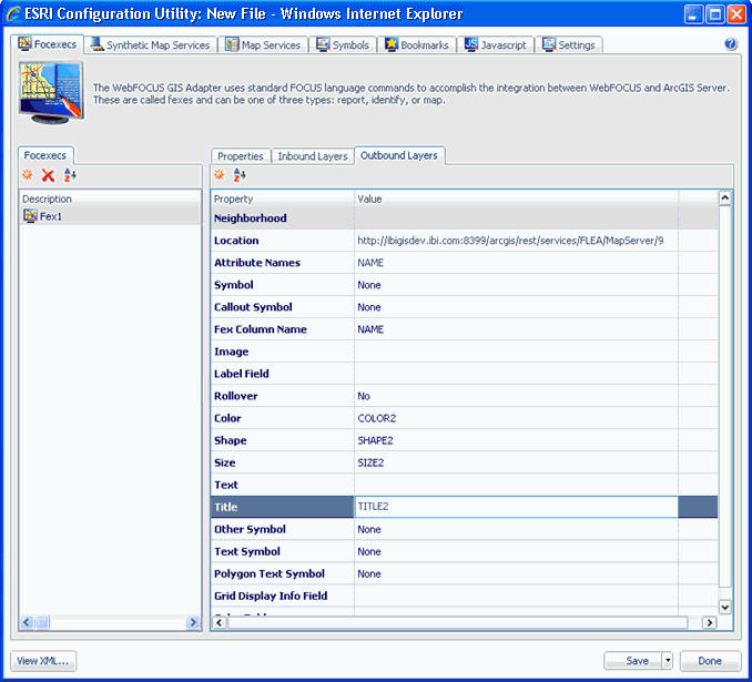
INBOUND layer definitions. Create the multiple OUTBOUND layer definitions
and associate the rendering elements with the appropriate layer
in the definition.
xDrawing Identical Map Layers Using Alternative Methods
You may encounter situations that require you to show
the same map feature with multiple rendering styles. For example,
a polygon you want to display may be too small and difficult to
visually locate on a map. However, adding a symbol, such as a star in
a contrasting color could make it easier for the user to locate
the feature.
Begin by creating a FOCEXEC with a single TABLE request. Create
the fields you will associate with the layer to be rendered.
TABLE FILE data_layer
PRINT colname
-* Color for the POLYGON symbol
COMPUTE COLOR1/A12='RED';
-*
-* Color, shape, size for the POINT symbol
   COMPUTE COLOR2/A12='YELLOW';
   COMPUTE SHAPE2/A12='STAR';
   COMPUTE SIZE2/A12='15';
-*
   COMPUTE TITLE1/A255='your title goes here for the layer';
-*
-DEFAULT &FLTRLST2 = 'FOC_NONE';
...
WHERE some_field IN FILE &FLTRLST2;
-SKIP_FILT_1
-*ON TABLE PCHOLD FORMAT XML
END
-RUN
Make sure you use different names to keep the attributes correctly
identified.
Using the definition editor, create the configuration for the
FOCEXEC with duplicate outbound layer definitions. Specify a different
SYMBOLID for each of the layer definitions.
In this example the first definition will use a POLYGON symbol.
Associate the field COLOR1 to the COLOR attribute.
The second definition will use a POINT symbol. Associate the
fields COLOR2, SHAPE2 and SIZE2 to the appropriate attributes. When
you are finished, the XML definition will look like the following
example.