When chaining maps with other controls in HTML Composer, you are able to pass fields that are not displayed by the map. These fields can be passed from one control to the map and then from the map to another control, where those undisplayed fields will then be used.
The following example shows how a map can be chained with other controls and how it can pass fields through the map for use later in the chain. For this example, the centurystores Master File was used.
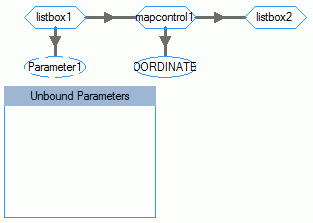
This example contains an HTML page that has two list boxes and one map control. The Design tab view of this page is shown in the following image.
The Parameters tab view shows that these controls are chained together, as shown in the following image.
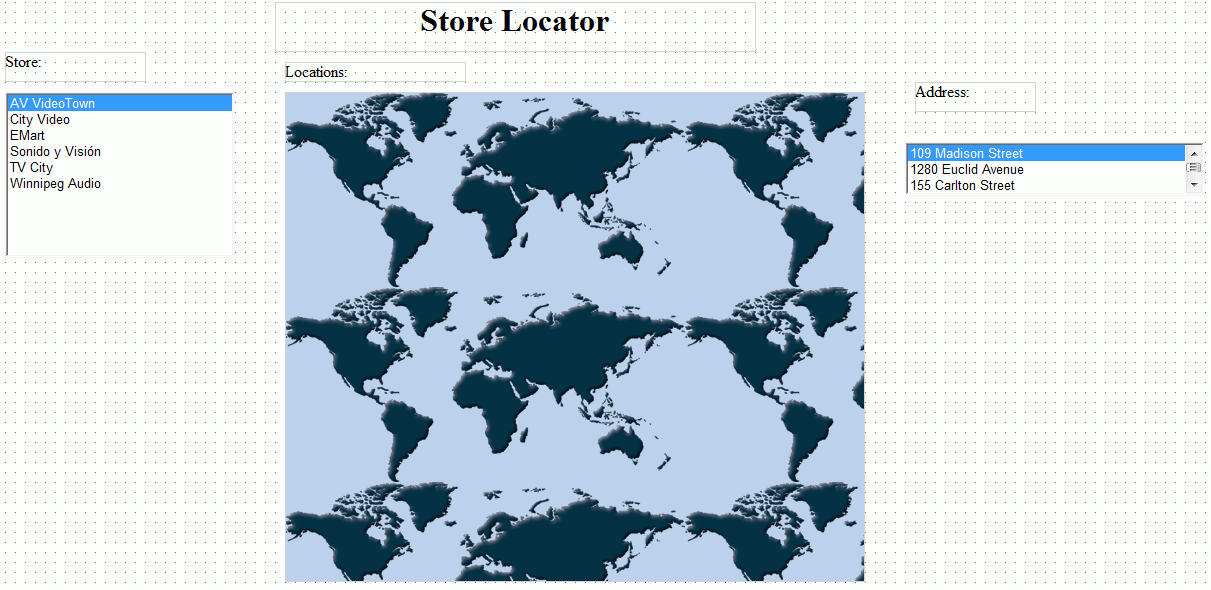
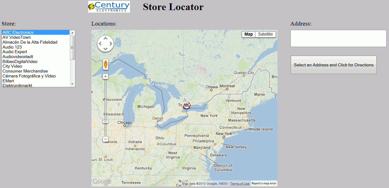
Listbox1 is populated with a list of store names from the centurystores Master File. When one of the stores on the list is selected, the store location is shown on the map, as shown in the following image.
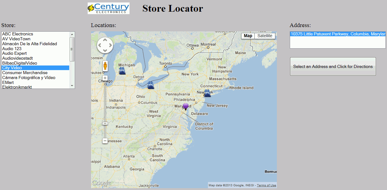
When the store marker image is selected on the map, the store address is displayed in listbox2, as shown in the following image.
Listbox1 passes the necessary fields to mapcontrol1 so that it can display the store location on the map. In this case, it passes the STORENAME field.
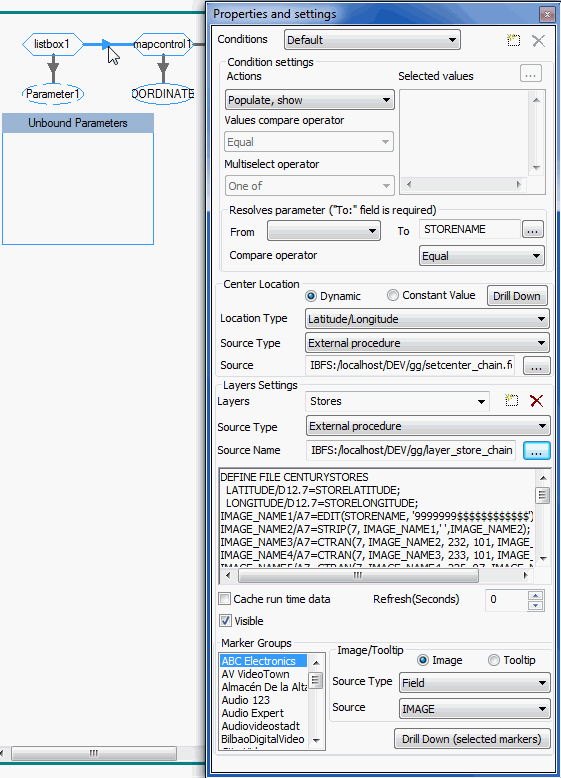
The layer procedures include BY STORENAME to filter the layer to show only the markers for the selected store in listbox1. The layer procedures also include a BY STOREID reference, which the map does not display, but is used in listbox2 to retrieve the correct store address for the selected map marker.
Mapcontrol1 does not use this field. However, when the store marker is selected on the map, the STOREID field is passed from mapcontrol1 to listbox2, as shown in the following image.
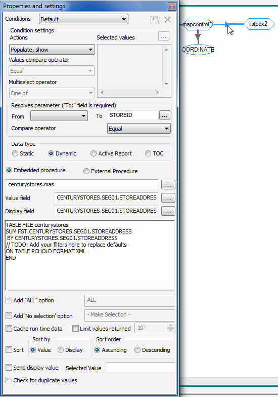
STOREID is passed to listbox2 where it is used to filter out the store address from the selected marker.
Maps can pass fields that they do not display. They can then pass those unused fields to another control, down the chain, which can use the passed fields.
| WebFOCUS |