Map services must be initially published using the ArcGIS Server Manager Console. They are considered as ArcGIS services that allow maps, features, and attribute data to be available inside client applications. Once published, map services are referenced by inbound and outbound layers. The following types of map services can be created for a Geographic Business Intelligence Solution (GBIS):
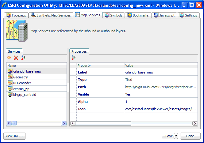
The following image shows the XML definition file (esriconfig_new.xml) being edited in the ESRI Configuration Utility. The esriconfig_new.xml file is used by the Retail Predictives sample application. In this image, the Map Services tab is selected.
The Retail Predictives sample application uses the following map services:
Tiled
Dynamic
Geometry
Geolocator
| WebFOCUS |