Most GIS software supports a concept of a free-form layer. In ArcGIS Server, this is known as an acetate layer. Acetate layers allow the developer to place any map related information where the user can view it. An acetate layer by itself is not capable of supporting end-user interaction. WebFOCUS synthetic layers take acetate support to the next level by supporting end-user selection of features to be used as filter values for report and graph requests.
Synthetic layer information is obtained using database queries that retrieve unique feature values along with the latitudes and longitudes of the features. An example of this uses data that is collected by the U.S. Geological Service about recent earthquakes. This information is published in a variety of formats on the USGS website. WebFOCUS can read this information across the Internet and use the latitude and longitude of the earthquake epicenter to display those locations on the map.
WebFOCUS also supports the drawing of lines between multiple points on the map. When the latitude and longitude data is retrieved along with a common data value for multiple points, WebFOCUS will instruct ArcGIS Server to connect those points together. An example of this is the multiple points along the current and projected path of a hurricane. All the points share the same storm name, which will be used to link them together.
And finally the last type of synthetic layer that is supported is a polygon. Polygons are also collections of latitude and longitude values for a common data value. The difference between a synthetic line and synthetic polygon is that WebFOCUS will instruct ArcGIS Server to complete the polygon shape between the last point and the first point of each unique grouping of points.
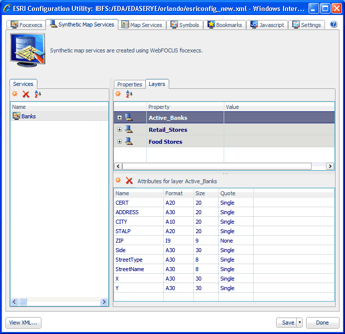
The following image shows the XML definition file (esriconfig_new.xml) being edited in the ESRI Configuration Utility. The esriconfig_new.xml file is used by the Retail Predictives sample application. In this image, the Synthetic Map Services tab is selected.
The Retail Predictives sample application uses a synthetic map service called Banks, which has the following synthetic layers defined:
| WebFOCUS |