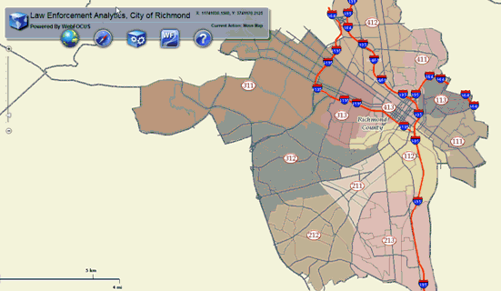
The Geographic Business Intelligence Solution (GBIS) that is enabled by the integration between WebFOCUS and ESRI ArcGIS Server allows three types of reports to be generated by using the mapping interface:
Using a mapping interface, users can create a WHERE clause using a specific location to drill-down to a WebFOCUS report, as shown in the following image.
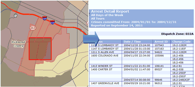
Map reports are generated by drilling down from a map, as shown in the following image.
This allows users to visualize results from a WebFOCUS report on a map by using color, size, picture, and shape to define the data represented on the map.
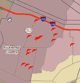
The identify reports are single location based queries, as shown in the following image.
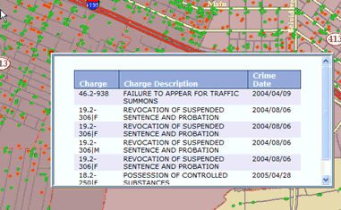
Once the user clicks on a specific location, the map receives information from the WebFOCUS Reporting Server to display the information in a contextual window on the map. This functionality can includes callouts, rollovers, and so on.
| WebFOCUS |