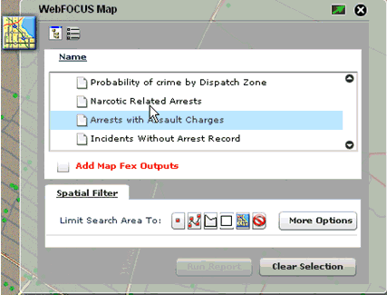
The WebFOCUS Map component is accessed from the WebFOCUS menu control drop-down list. This component opens on the right side of the screen under the component manager or under the last opened component.
The WebFOCUS Map component allows you to run a map procedure. Select a report and then click on one of the map selection tools to select from the map view. Once the selection is completed, the report is executed automatically or by clicking on Run Report. By selecting the Add Map Fex Outputs option, you have the option of concatenating multiple outputs on to the map.
To open a more detailed view that allows you to perform more advanced map selections, click More Options.
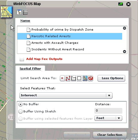
The map selection can be performed using any of the options listed and described in the following table.
|
Option |
Description |
|---|---|
|
|
Limits the search area to a point on the map. |
|
|
Limits the search area to a line on the map. |
|
|
Limits the search area to a free hand polygon on the map. |
|
|
Limits the search area to a rectangular polygon on the map. |
|
|
Limits the search area to the current map extent. |
|
|
Clears the selection graphic from the map view. |
There are spatial relationships by which you can use to select from the map, which include:
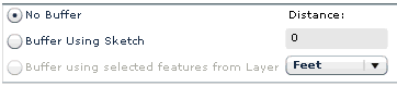
In the advanced options of the WebFOCUS Map component there is also the option of using buffers for selections. This is done by selecting the Buffer Using Sketch option. Then the measure of distance is provided with distance values in the input field and the units from a drop-down list.
Click Less Options at any point to collapse the WebFOCUS Map component to the original view.
| WebFOCUS |